


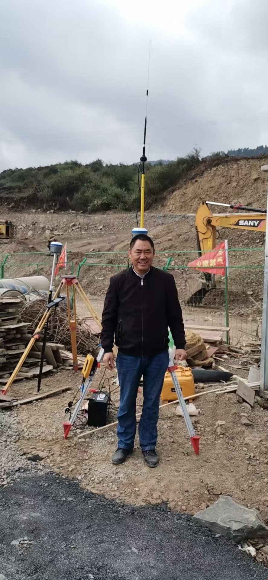
The Good Survey RTK M9 is an advanced real-time kinematic (RTK) positioning solution designed for high-precision surveying and
mapping applications. With cutting-edge technology and robust performance, the M9 ensures accurate data collection in various
environments, making it ideal for professionals in surveying, construction, agriculture, and environmental monitoring.
Search
Sign In Join Free


1 / 6
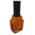
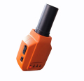
Customizable High Performance Data Integration GNSS RTK for Mapping Applications
$500.00
≥1 set
$481.00
≥2 set
$480.00
≥10 set
$475.00
≥20 set
Options:
- M9
Get Latest Price
You might also like
Basic Info
| Warranty | 3 Years |
|---|---|
| Customized Support | Oem |
| place of origin | China |
| Brand Name | Qianxun |
| Product Name | Measuring Instruments |
Show More
Product description

Products Description
M9
Rich auxiliary functions
QR code sharing data; Customize physical measurement keys; Intelligent voice reminder; Built in help documents, manual
differential positioning, boundary reminder, trajectory recording, area measurement on the map, land parcel information input,coordinate calculation, interpolation calculation, and filling calculation; Share data through QQ, WeChat, and email; FTP wireless data transmission.
differential positioning, boundary reminder, trajectory recording, area measurement on the map, land parcel information input,coordinate calculation, interpolation calculation, and filling calculation; Share data through QQ, WeChat, and email; FTP wireless data transmission.
Road measurement
Support complex road layout and cross-section collection. Provides road line design functions, including flat section line,
cross-sectional line, longitudinal section line design, slope design, and supports chain breakage, superelevation, and widening.
cross-sectional line, longitudinal section line design, slope design, and supports chain breakage, superelevation, and widening.
Base map loading
Support CAD (dwg, dxf), ArcGIS (shp) vector graphics clipping as base map, support IPG, tif images as base map, Baidu online map.
Electric power
Road survey, pole tower layout, tower base section measurement, use electric power post-processing software to edit and convert to Daoxiang format.
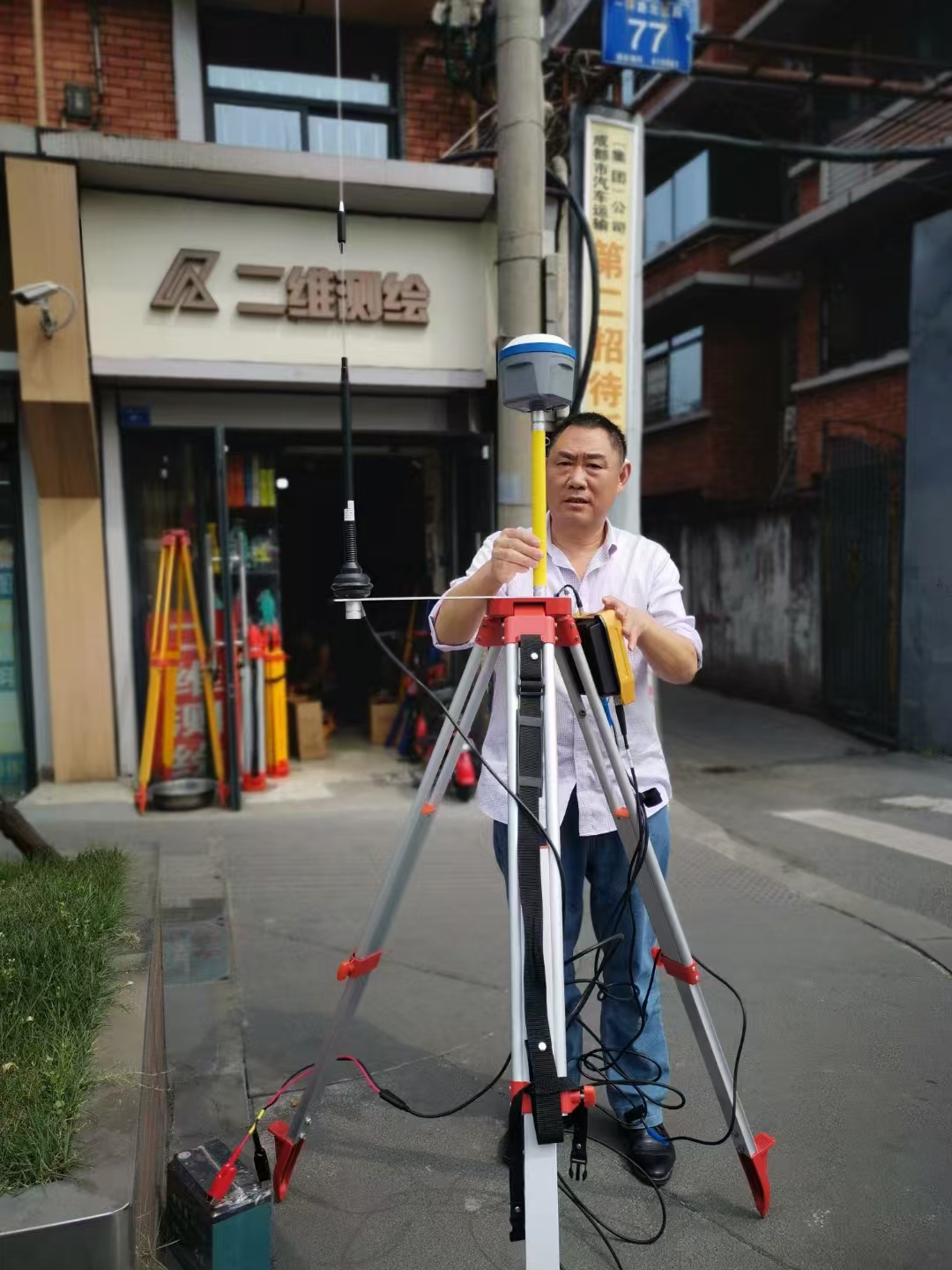
Total station measurement
The handbook connects to the total station via Bluetooth for measurement, and obtains coordinate display point drawing in real time. The company's long-distance support (500-2000m) blue digital external module can be used to effectively solve the problem of llimited distance of total station Bluetooth use. At the same time, it supports total stations without Bluetooth function, making it more efficient and convenient to follow the reflector for mobile surveying and staking.
Point, line and surface staking
Supports staking out points and lines on the map, and staking out any point on the screen; the electronic compass points to the target in real time, and the fine-tuning view displays accurate point finding. Jinli DTM triangulation network elevation staking out at any position, and the triangulation network staking out generated by the new CASS.
Efficient electronic sketch drawing
Original "electronic sketch" operation mode: hand-drawn line, polyline object capture fast drawing, automatic drawing and manual drawing clear diagram interaction effectively solve the reasonable allocation of internal and external work, greatly improve work efficiency. Built-in national standard symbol library, exported to CAD (dwg/dx) mainstream graphics, attributes, line types, layers are fully compatible with Southern CASs or Tsinghua Shanwei EPS. Text, photos, videos, and audio recordings can be played into the drawing in real time, recording a large amount of information to support the creation of custom symbols (CAD reference blocks).
Collaborative work
The preparation groups can share data results in real time to avoid the trouble of measurement and missed measurement.
Product Paramenters
Satellite reception
| B1I/B2I/B3I/ BI1C/B2a/B2b.??L1C/A/L2P(Y)/L2C/L5,?L1/L2,?E1/E5a/E5b,?L1/L2/L5 |
Number?of?channels
| 1408 |
Single point accuracy | Plane: 1.5m Elevation: 2.5m |
positioning accuracy | RTK accuracy: H: ± (8+10 * xD) mmV: ± (15+10'xD) mm |
Laser measurement accuracy | Laser tilt measurement three-dimensional error * 1cm+5mm/m (note: equivalent to the measurement accuracy using a centering rod) |
Speed accuracy | ≤ 0.03m/'s |
Tilt angle | 0°-30°:≤+1.5cm; 30-120°: +1.5~3.0cm |
Inertial compensation accuracy | 1.8m pole,?RMS:10mm+0.7mm/tilt |
IMU update rate | 200Hz |
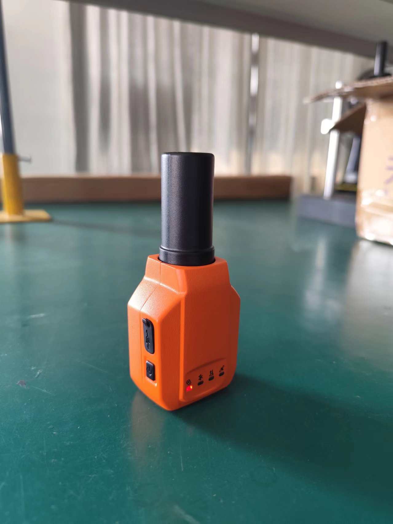
Power supply voltage | 5V/2A |
Working time | ≥12h |
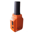
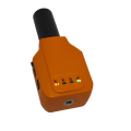
Charging interface | Type-c |
Bluetooth | BT4.1 dual-mode Bluetooth |
Waterproof and dustproof | IP67 |
Drop-proof | Resistance to 1.6 meters free fall |
Working temperature | -20°C~75°C |
Storage temperature | -40°C~85°C |
Buttons | Power switch button |
Casing material | Polymer Engineering Materials |
Centering Pole interface | 1/4-20 UNC |
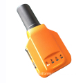
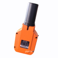
Indicator light | 1 power light, 1 Bluetooth light, 1 differential light, 1 satellite light |
Dimensions | 139x63x40(mm) |
Weight | 190g |


Application


Shipping & Payment


Customizable High Performance Data Integration GNSS RTK for Mapping Applications
$500.00
≥1 set
$481.00
≥2 set
$480.00
≥10 set
$475.00
≥20 set
Options:
- M9
Get Latest Price
Send your inquiry to this supplier
You may also be interested in
Product Categories
New products


Send Inquiry
Product Alert
Subscribe to your interested keywords. We will send freely the latest and hottest products to your Inbox. Don't miss any trade information.
Subscribe
Your use of this website constitutes acknowledgement and acceptance of our Terms & Conditions.
Copyright ? 2009-2026 Bossgoo Co., Ltd. All rights reserved.
